MX V3
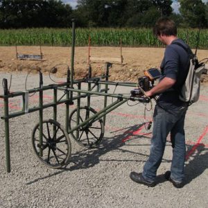
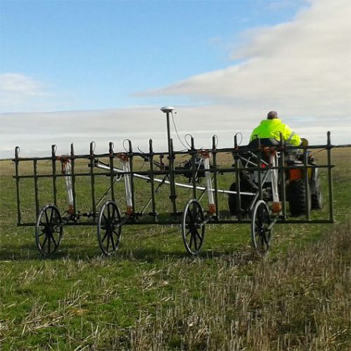
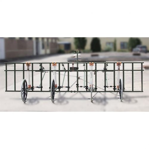
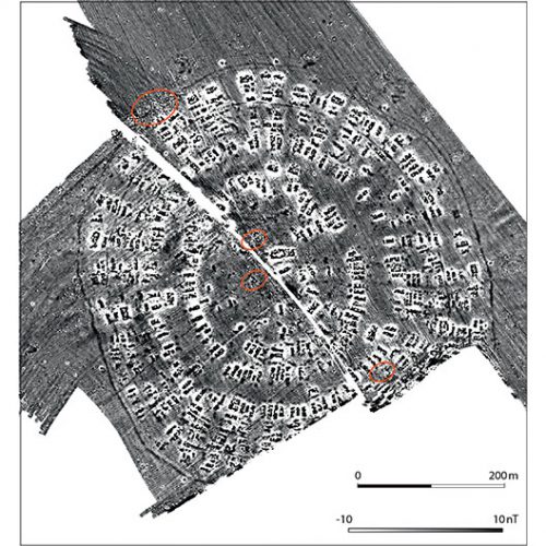
The MAGNETO MX V3 is a large area magnetometer survey system. It can host up to 16 fluxgate gradiometers on a trailer having a width of 3.85m. This allows a rapid non-invasive cartography on land in order to search for UXO or archaeological structures as well as doing large scale soil evaluations.
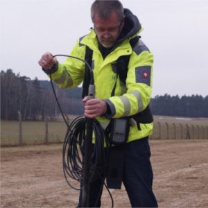
One of the unique features is the modular trailer that can be set up in various configurations to be carried, pushed or pulled. The survey width can be adjusted from 1m to 4m. Furthermore, the compact data acquisition unit offers high sampling rates, 24Bit digitizing of all measurement data and an Ethernet interface to output the data. Thus, the survey system is very flexible to interconnect with third party components and systems. A wireless option is available. At the maximum survey speed the system is capturing data every 20 mm.
In order to reach a positioning accuracy of ±1 cm for every measurement point, the MX V3 is equipped with a RTK DGPS. The GPS rover station is mounted to the car while the GPS base station (reference point) is set next to the measurement area.
Description
Technical Specifications
Power Supply : 12 V battery pack (lead gel)
Dimension of Carrier : Length : min. 1.2 m (pushed) , max. 4.50m (towed) ; Height : 1.3m
Weight : 45 kg
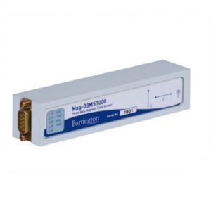
Sensor System
FGM650/10 : sensitivity : 0.5V/microT ; range : +/- 10.000 nT
FGM650/3 : sensitivity : 0.6V/microT ; range : +/- 8.000 nT
Area Coverage
Maximum daily coverage : 20 ha
Data
Data acquisition
Analog input : 16 channel max
Position accuracy : +/-1 cm (with RTK DGPS)
PC Interface : LAN, 100 Mbits/s
Measurement configuration
Distance between probes : 0.25m min
Sensor above ground level : 0.1m to 0.4m
Maximum survey speed : 15 km/h ; 9mph
Data density : 20mm