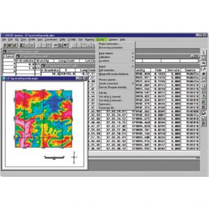
2D/3D-inversion software RES2DINV/RES3DINV
The RES2DINV/RES2DINV programs use the smoothness-constrained Gauss-Newton least-squares method inversion technique to produce a 2D/3D model of the subsurface from the apparent resistivity data alone. It is completely automatic and the user does not even have to supply a starting model.
This program has been optimised for the inversion of large data sets. The use of available memory is optimised so as to reduce the computer time by minimising disk swapping. On a modern microcomputer, the inversion of a single pseudosection is usually completed within seconds to minutes. Four different techniques for topographic modelling are available in this program. Together with the free 2D forward modeling program RES2DMOD, it forms a complete 2D resistivity forward modeling and inversion package.
Description
Technicals specifications
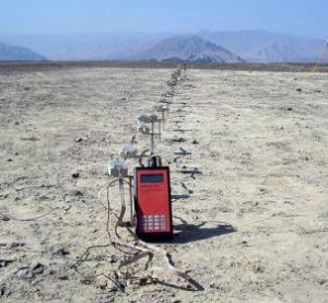
Supports on land, underwater and cross-borehole surveys.
Supports the Wenner (alpha,beta,gamma), Wenner-Schlumberger, pole-pole, pole-dipole, inline dipole-dipole, equatorial dipole-dipole, gradient and non-conventional arrays.
Supports exact and approximate least-squares optimisation methods.
Supports smooth and sharp constrasts inversions.
Supports up to 16000 electrodes and 21000 data points on computers with 1GB RAM.
Supports up to 125000 data points on computers with 24GB RAM (RES2DINVx64).
Seamless inversion of very long survey lines using sparse inversion techniques.
Data
The program will automatically choose the optimum inversion parameters for a particular data set. However, the parameters which affects the inversion process can be modified by the user.
The smoothing filter can be adjusted to emphasize resistivity variations in the vertical or horizontal directions. Two different variations of the smoothness constrained least-squares method are provided; one optimised for areas where the subsurface resistivity varies in a smooth manner (such as chemical plumes), and another optimised for areas with sharp boundaries (such as massive ore bodies).
A robust data inversion option is also available to reduce the effect of noisy data points. Resistivity information from borehole and other sources can also be included to constrain the inversion process.