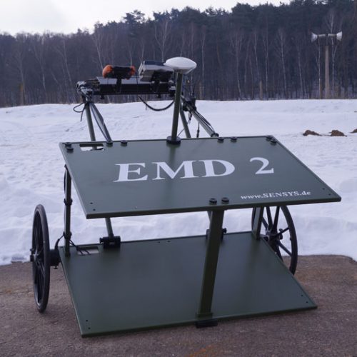
EMD2
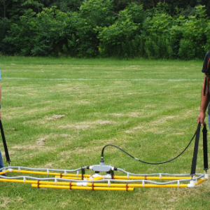
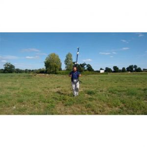
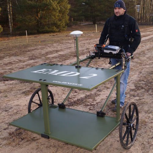
The EMD2 is an active, highly sensitive system for middle sized area surveys using the TDEM (“Time Domain Electro-magnetics”) method in order to detect metals in the ground.
It is made for high-precision electromagnetic cartographies of small and middle sized areas in order to support UXO and EOD teams, geophysicists or archaeological surveys.
The EMD2 is equiped with three pairs of differential receiver coils. Thus giving a higher resolution than single coil/loop systems for an optimized identification of objects (especially on areas with significant magnetic impacts).
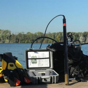
The captured values will be recorded with the MXPDA electronics. It can be used with an RTK DGPS in order to allow accurate and free navigation in field, straight display of survey lines and a georeferencing of the measurement data.
Description
Technical specifications
General technical data
Power supply 12 V lead gel battery.
Total weight of system (with wheel set) approx. 20 kg.
Dimensions of frame
Length approx. 2 m.
Width (incl. Wheel set) approx. 1.6 m.
Height (incl. wheel set) approx. 1m.
Sensor system
Sensor system EMD2
Coils 1 transmitter coil (bottom) ; 3 receiver coils (bottom) ; 3 receiver coils (top).
Size of coil (transmitter coil) 1.2 x 0.8 m.
Size of coil (receiver coil) 0.4 x 0.4 m.
Measurement configuration
Pulse frequency 500 Hz.
Measurement range 0-10,000 mV.
Vertical distance of coils 0.64 m.